Digital Company news South Africa

Optimising efficiency and improving profits with geospatial data

Have you ever stopped to think of all the things you cannot do unless you have an address? An address is needed to open a bank account, to get a driver's licence, to apply for an identity document and a passport. You need an address to enrol your kids at school and to register to vote. Your address is the place you call home.
Marna Roos
Marna Roos

For businesses, being able to find an address is critical. It’s not possible to sell services or products to people if you don’t know where they are. Fast-food and online shopping deliveries would be impossible without addresses that allow retailers to locate their customers. That’s how we learn about the makeup and character of communities and how places are changing.

But getting a valid address isn’t always easy. One of the challenges is that people are often unaware of the differences between crowd-sourced address data and verified and validated address data. Although free, crowd-sourced data is unreliable.

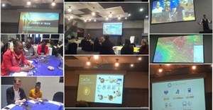
After 25 years of verifying and validating address data across South Africa, it’s a mammoth task that we have mastered. We collect data from 226 municipalities as well as other government organisations like the Surveyor General. We check it, fix it, and link all the various data sources. Then we assign a unique identifier to each location so that we can track any changes over time. We can tell, for example, if ERF 728 and 43 Tsakane Road are the same property.

Driving up profitability

These are just some examples of the wins achieved by organisations using accurate geospatial data:

  • Quality spatial data is having a big impact on the profitability of many South African companies. A well-known South African courier service improved its first-time delivery success rate by 93% in two years, not only improving customer satisfaction, but also increasing profitability. This has turned the company into one of the biggest names in logistics.

  • Using good quality geospatial data, a mass rapid public transit system created a web portal for passengers so they could easily use interconnected types of transport to get where they are going.

  • One of the big four South African banks, with more than 8 million clients, had multiple addresses in a number of databases in different business units. Many of the addresses were incorrect and contained errors. This had a negative impact on Know Your Customer (KYC) and affected product and customer expectation down the line. The result was loss of market share and penalties for lack of compliance. Now, with accurate address data at the first point of capture – as well as validated, fixed, and geocoded addresses, each with a unique identifier – the bank has a single view of clients, even if they use multiple address formats or completely different addresses.

  • A mobile network operator (MNO) improved its first-time handset delivery success rate, which has a direct impact on profitability. The same cellular service provider also developed a closest points of interest (POI) application for its subscribers to find things like ATMs, fast food, restaurants, healthcare, accommodation, retailers, recreation and more.

Spatial decision-making exploits the centralised spatial data that links data to a specific place on Earth. Companies that do this better than their competitors can drive more business, save more money, and understand customers better so they can become exponentially more profitable and sustainable.

About AfriGIS

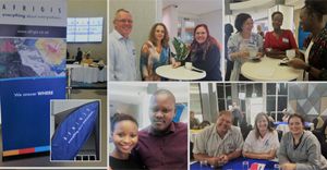
AfriGIS is the leading Geospatial Information Science company in Southern Africa that specialises in location-sensitive data and solutions. It provides customers across the board with a suite of web-based tools and APIs to connect to, enhance, and enrich their own data with location intelligence, insights, and trusted data. The organisation was founded in 1997 and celebrates 25 years in business this year. It is a level 1-certified broad-based black economic empowerment (B-BBEE) business, with more than 100 employees, in Pretoria, Durban and Cape Town in South Africa, Dublin in Ireland, and Dhaka in Bangladesh.

About Marna Roos

Marna Roos is a senior account manager and standards enthusiast at AfriGIS.
AfriGIS
We create ONE OF A KIND GEOSPATIAL SOLUTIONS. We use geospatial information science to bring information about WHERE to life across industries and in any application. This helps our clients unlock value through better business intelligence.
Let's do Biz